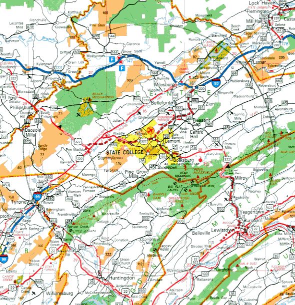
The State College Bird Club focuses on the birds
within the 25 mile (40.2336 km) radius circle centered at
(40.7964,-77.8630) which is a point on the Old Main Building on the Penn
State campus.
The static map below is a rough approximation (scanned from the 2002
edition of the publically distributed Pennsylvania Official
Transportation and Tourism map).
A far more accurate map with zooming and dragging capability is available here (to get a FULL SCREEN display of the map, scroll down and click on MAP OPTIONS and then FULL SCREEN). Please note that the copyright restrictions permit only viewing on a computer through a web browser like Firefox or Safari.
To see the circle in Google Earth (you must have
Google Earth on your computer), OPTION-click
(on a MAC) this link to download a 5KB kml file to your DOWNLOADS folder
(or CTRL-click on a Windows computer), and in Google Earth click
FILE/OPEN on the menu bar and OPEN the downloaded file
SCBIRDCLCircle.kml. Then, for example, you can use the Google tool
RULER to find the distance between any two points or the length of a
path or road within the circle. Google Earth is a free computer program
(uncheck the box at the top or the Google Chrome browser will be
bundled in the download).